
huh. #OsmAnd refuses to render offline maps as soon as I update a region to the April release… but still renders the non-updated regions, and also renders all of them if I switch to the old (non-OpenGL-)rendering engine. Strange.
Recent searches
Search options

#osmand
12 posts11 participants0 posts today

Two hour mapping session with almost 300 solved #StreetComplete quests and 70 #OpenStreetMap local notes over 6 km.

Replied in thread

La ROM Android alternative « eOS » (@e_mydata ) a choisi l'appli #Magic_Earth pour la navigation via #GPS.
https://doc.e.foundation/maps
Non libre, mais un compromis selon eux. Je l'utilise régulièrement.
Et au rayon vraiment Libre : #OSM_And @osmandapp
https://f-droid.org/packages/net.osmand.plus
doc.e.foundationMaps application
Replied to dasgrueneblatt

@dasgrueneblatt Locally, you can easily display #OsmAnd favorites by just open it in #JOSM, but it does not looks very nice. For local customization, it is quite easy to enable labels with just a few clicks in #QGIS. Or (esp. if you want to publish the map) you can use service like https://umap.openstreetmap.de (you also need to enable labels either as always-on or on-popup in GPX layer)
umap.openstreetmap.deuMap - Online map creatoruMap lets you create maps with OpenStreetMap layers in a minute and embed them in your site.

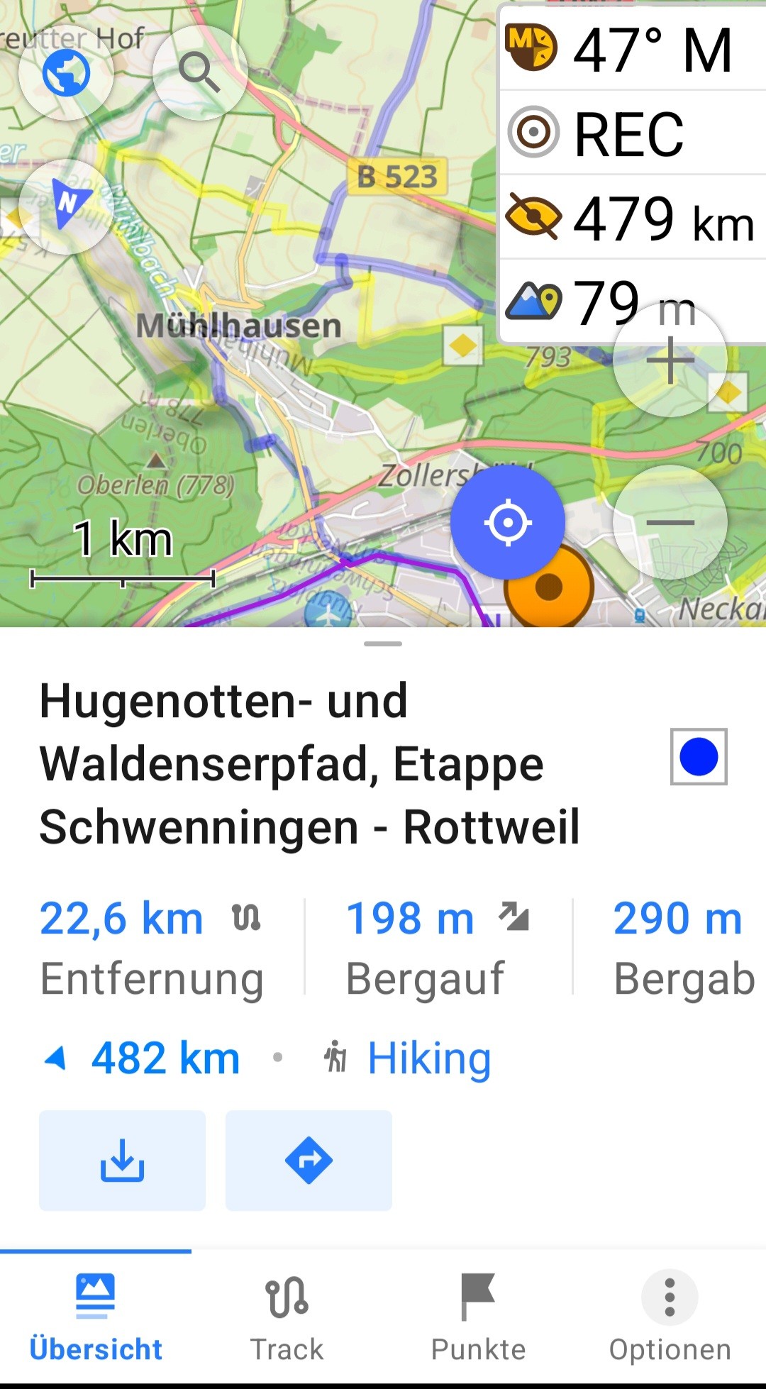
I have lots of favorites (starred places) in #OSMand and I want to view them on a map on a bigger screen, not just on the phone. When I export them, I get a favorites.gpx file.
As far as I understand, these are waypoints on a track?
I opened the file in the nextcloud map, and it displays the points, but without any text.
The entries look like this:
<wpt lat="51.5320587" lon="-0.1773316">
<time>2025-01-18T22:23:30Z</time>
<name>Abbey Road Crossing</name>
<extensions>
<osmand:amenity_subtype>attraction</osmand:amenity_subtype>
<osmand:address>Abbey Road (South Hampstead), Camden Town</osmand:address>
<osmand:amenity_origin>Amenity:Abbey Road Crossing: tourism:attraction</osmand:amenity_origin>
I tried converting the file to (geo)json, but so far the file has come out empty. I realize I don't really know what I'm looking for. It doesn't have to be nextcloud compatible at all, that was just the first thing I had on hand.
I would like to see the points and their names on a map on a bigger screen.
Any suggestions please?
Replied in thread

@kasimir
#OsmAnd nutzt auch #OSM Daten und ist meiner Meinung nach besser als #OrganicMaps beim Fahrrad-Routing.
Replied in thread
@dipolecat Download #OsmAnd from the FDroid Store. In this version you can download as many maps as you want.
Replied in thread

@eliasp thanks for that link. helpful info.
i tried to look before but i only found this wiki page which was less detailed: https://wiki.openstreetmap.org/wiki/Item:Q230
> diet:vegan, Whether the establishment offers vegan products.
now i wonder whether it's possible to actually search for these #vegan only restaurants somehow, in #organicmaps or #osmand, or whether i should kindly suggest it be implemented ...
wiki.openstreetmap.orgdiet:veganWhether the establishment offers vegan products.

Hallo Fediverse,
kürzlich hatte ich bei einer Unterhaltung das Thema GoogleMaps. Es wurde gesagt, dass die Sympathie ja auch nicht bei Google liege, jedoch mache man davon Gebrauch, da dort die [POI] so unkompliziert zu finden und mit Zusatzinformationen befüllt sind. Ich selbst verwende #osmand.
Gibt es weitere Alternativen, die ich vorschlagen könnte (besonders zur Online-Nutzung)?
#unplugtrump

An even better Komoot alternative? – OsmAnd
jlelse.blogAn even better Komoot alternative? – OsmAnd - Jan-Lukas Else
More from  Jan-Lukas Else

Jour 8 : Sortie progressive des #GAFAM
Google Maps → Quelle Alternative???
Vous saviez que chaque fois que vous utilisez Google Maps, vos trajets, vos recherches et vos habitudes sont enregistrés et vendus à des entreprises ? 
Les assureurs, les agences de pub, les géants du retail et même les gouvernements sont intéressés par ces données.
 Alternatives open-source et respectueuses de la vie privée :
 Organic Maps : Léger, rapide et parfait pour les déplacements hors ligne. OpenStreetMap : La carte collaborative, gratuite et sans traçage. OsmAnd : Fonctionnalités avancées avec navigation hors ligne et cartographie détaillée.


#FediAsk / #BikeTooter : Is there a #free and #opensource software ( #FOSS ) on #Android for #bike #navigation which allows to upload a #GPX route, *easily* and quickly modify it before as well as *during* navigation, and at the end download the GPX file? I love the #OsmAnd navigation tool, but, since I am by far not a #geek ,somehow fail to quickly modify the tracks.
Thank you.

Hmm, privacy tip. OsmAnd sends a "unique ID" when you download offline maps, UNLESS, you turn off that identifier. Any kind of UUID transmitted over the web is unfortunately (another) digital footprint ad companies and whatnot can use to follow you through life. You can turn it off. #osmand #privacy #tracking


ma è normale che #osmand non giri i nomi delle strade e dei luoghi quando giri la mappa?
Replied in thread

Die Frage ist: Braucht es zukünftig eine ähnliche „Wollmilchsau“? Vielleicht nicht. Vielleicht reicht eine Kombi aus spezialisierten Tools: #OSMAnd für Offline-Karten, #Bikerouter für Routing, #QGIS für Tourenverwaltung.
Auch wenn #Komoot jetzt neue Wege geht, die nicht allen gefallen: Es gibt Alternativen, die für einzelne Anwendungsfälle oft besser sind – und viele davon sind #OpenSource. Vielleicht ist das die Zukunft: Freiheit, Flexibilität und freies Wissen.
Danke fürs Mitdenken! 

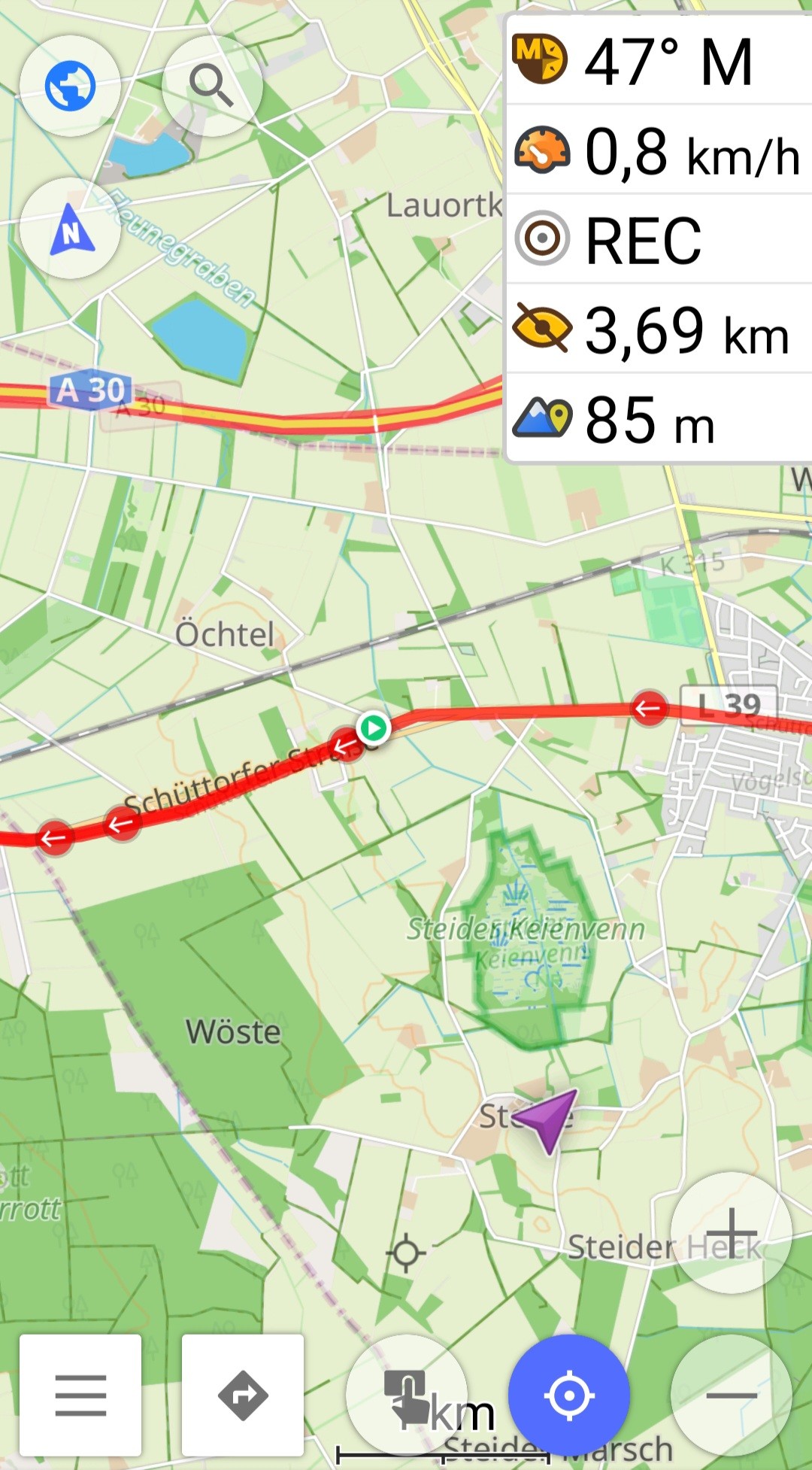
Nette Menschen beim @adfc_stuttgart getroffen und erfolgreich mein #Lastenrad codieren lassen. Top Ausflug, nur das Routing von #OSMAnd war komplett whack, wäre ich danach gefahren hätte ich durch sinnloses Kreuzen locker ne halbe Stunde mehr gebraucht
Und "mit dem Lastenrad willst Du bestimmt die Stichstrecke ausm Feuerbacher Tal hoch" hätts Auch nicht gebraucht.
Replied in thread

Natürlich geht das mit #openstreetmap #osmand #organicMaps und co.
Auch #Radwege
Wann lernen die User es eigentlich?
Das System ist immer das gleiche!
#User bezahlen für eine App wie #Komoot Xy € und füttern diese #kostenlos mit Inhalt.
Dann werden die #Daten verkauft....
Nehmt #opensource Alternativen rund um #openstreetmap wie #organicMaps, #osmand und viele mehr
Diese #tracken auch nicht und der #Datenschutz ist wesentlich besser!
Replied in thread

@ascentale
A8. I've had numbers from our numbered-node cycle network taped all over my top-tube. A long list to cover 100+ km. Not the shortest route, but works like a charm.
A phone running #OsmAnd, pre-made route, powerbank in frame bag has also worked well.
Lastly, when on vacation by bike we mostly have a map on top of our handlebar bag, that we can constantly check.
@t54r4n1 @bikenite